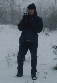
Carlos Gata Maya - Project manager
-
 Licenciatura en Ciencias Físicas (Physics Sciences Degree), speciality in Geophysics, in the Faculty of Physics of the Complutense University of Madrid (UCM) (1997)
 -
Doctorate courses in Geophysics (1997-98 y 98-99) in the UCM
-
Course Sondeos y diagrafías (Well logging) in the "Fundación Gómez-Pardo" (March, 1998).
( Click here to download a pdf with the curriculum.)
PROFESSIONAL EXPERIENCE
2011-Present. Founder and project manager of all the geophysical surveys in GAMA GEOFÍSICA, S.L.
2004- 2011. Partner and project manager of the geophysical surveys with seismic, electric and GPR methods in GEOGNOSIA, S.L.L.
1999-2004. Geophysicist in ORELLANA CONSULTORES S.A. (OCSA).
1998-1999. Junior geophysicist in the mining exploration companies Riomín Ibérica S.A. and Rio Tinto Finance & Exploration Portuguese Branch plc. (RIO TINTO plc. group).
Involvement in more than 500 projects of geophysical prospecting, begin the main responsible and coordinator in more than 300 of them. These projects were developed in different countries: Spain, Portugal, Morocco, Algeria, India, Panamá, Dominican Republic. Brasil, Chile, Ecuador,... The main areas of interest in the development of these projects were the following:
-
Civil engineering: Roads, highways, railways, high-speed railways, tunnels, dams, and pools, channelling, electric sub-stations, power stations, industrial plants, wind power plants, solar plants, ...
-
Geotechnics and construction : Geotechnic knowledge of structures, construction forensics, location of cavities or anomalous areas in foundations, ...
-
Hydrogeology: Location of lithologies which are potential aquifers, better hydrogeological understanding of different areas, agronomy studies, research in wetlands and reservoirs, definition of marine intrusion, ...
-
Mining: Mining exploration, deep geological research for CO2 storage or geothermal energy, surface mining studies (quarry), ...
-
Environment and archaeology: Characterization of the mining pools, study of dumping sites, contamination studies, archaeological investigation, ...
GEOPHYSICAL METHODS EMPLOYED
-
Seismic methods: S and P waves refraction, reflexion, surface wave (MAM, REMI, MASW 1D and 2D,...), down-hole, cross-hole, seismic tomography, ... …
-
Electrical methods: Electrical tomography (ERT), vertical electrical sounding (VES), induced polarization and resistivity profiling.
-
Potential methods: Gravimetry and magnetometry.
-
Electromagnetic methods: Ground Penetrating Radar GPR, Time-domain Electromagnetic (TDEM), Magnetotelluric and Audio-Magnetotelluric (MT and AMT), Audio-Magnotelluric Controlled Source (CSAMT), nanoTEM, light electromagnetic (EM-31 y EM-34), ...
-
Geophysical logging.
-
Thermal properties studies (conductivity, resistivity, diffusivity ...).


