Ground Penetrating Radar GPR
The geophysical method of GPR (Ground Penetrating Radar) studies the reflections of electromagnetic signals produced by a transmitter antenna and collected by another antenna, in this case the signal receiver, located in a mobile, lightweight and easy-to-use device.
This electromagnetic method uses high frequencies (from 20 MHz to 1 GHz). This allows obtaining very high resolution in the study. However the penetration depth is very low (a few meters).
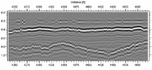
In GPR studies the antenna slips on the ground, giving a real time signal registration (radargram) on a screen. Maximum amplitudes correspond to the signal reflected at terrain discontinuities (lithological changes, presence of holes, services or galleries, archaeological remains…).
This technique is used routinely in location services, cavities, or archaeological, detection of tunnels...
The main georadar problem is the studied depth since the high frequency is attenuated very quickly in the media. This reduction is higher for more conductive media (presence of water, conductive materials...). As a result antennas have wide ranges of penetration, depending on the frequency (the bigger the frequency is the higher resolution and lower penetration are obtained) and on the characteristics of the environment.


